Hurricanes stand as both awe-inspiring wonders and formidable forces of destruction. In this article, we journey into the heart of hurricanes, discovering how they are formed, the characteristics that define their structure, and the devastating damage they leave behind.
Jump to:
Causes of Hurricanes - How Do Hurricanes Form?
Hurricanes are born from a complex mixture of atmospheric conditions, mainly warm ocean water, moist air, and an unstable atmosphere. The warm ocean water acts as the fuel and provides the heat and moisture a hurricane needs. As air rises from the warm ocean, it carries the moisture with it and creates a zone of low pressure. It is this upward movement of moist air and the release of latent heat that creates a cycle, which will eventually grow into a hurricane.
There are 4 distinct stages in hurricane development:
- Tropical disturbance
When the warm ocean continues to heat up because of the sun, it releases water vapour into the air. As this vapour rises, it forms clouds, and shares this heat with the surrounding air. As the heat spreads, these clouds start to circulate around a centre in the same way water spins as it goes down a sink drain. Then as the warm air moves through more clouds, it transforms into a cluster of thunderstorm clouds - this is called a tropical disturbance.
2. Tropical depression
At this stage, the initial thunderstorm clouds begin to grow. Winds and moisture coordinate and form a distinct centre of circulation with wind speeds ranging from 23 to 33 mph. This forms the heart of the developing storm and soon to be hurricane. The atmospheric pressure within the system drops, indicating that the storm is strengthening. As the winds become more structured, the storm reaches a state of equilibrium, meaning it has stabilised and is ready to continue its development.
3. Tropical storm
As the stronger winds continue to develop, the tropical depression matures into a tropical storm. At this stage, wind speeds range between 39 and 73 mph and the storm is officially granted a name so that its development can be communicated and tracked. The cloud formations become more coordinated and symmetrical and start swirling around a more noticeable centre. These tropical storms are marked by heightened activity and are capable of causing damage, especially in coastal areas.
4. Hurricane
This is the climax when the tropical storm finally transforms into a hurricane. The storm has now reached its peak intensity with winds reaching a minimum of 73 mph. It has a well-defined eye (centre of the storm) surrounded by powerful winds and towering clouds. Hurricanes are categorised using the Saffir-Simpson Hurricane Wind Scale. Categories range from Category 1 (74 to 95 mph winds) to Category 5 (157 mph or higher winds). These hurricanes can cause heavy rainfall and severe destruction to the surrounding areas.
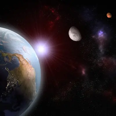
One of the main contributors to the formation of hurricanes is the Coriolis effect. It is the deflection of moving objects like air or water caused by the Earth’s rotation on its axis, making them deflect to the right in the Northern Hemisphere and to the left in the Southern Hemisphere. It is also the reason behind the pronounced spinning of dangerous storms. It is because of the Coriolis effect that the developing storm can organise itself and turn into a cyclonic system.
Recommended for you!
Best Sellers


Where do Hurricanes form?
Hurricanes predominantly form over warm oceans near the equator. Prime hurricane regions include the tropical and subtropical areas of the Atlantic, Pacific, and Indian Oceans.
The Atlantic hurricane season spans from June 1st to November 30th with the peak activity usually occurring between August and October. The Pacific has two distinct hurricane seasons. The Eastern Pacific season runs from May 15th to November 30th while the Western Pacific season lasts all year round with peak activity from July to November. Finally, the Indian Ocean sees its primary hurricane season from April to December, with the Bay of Bengal and the Arabian Sea being the main focal points for activity.
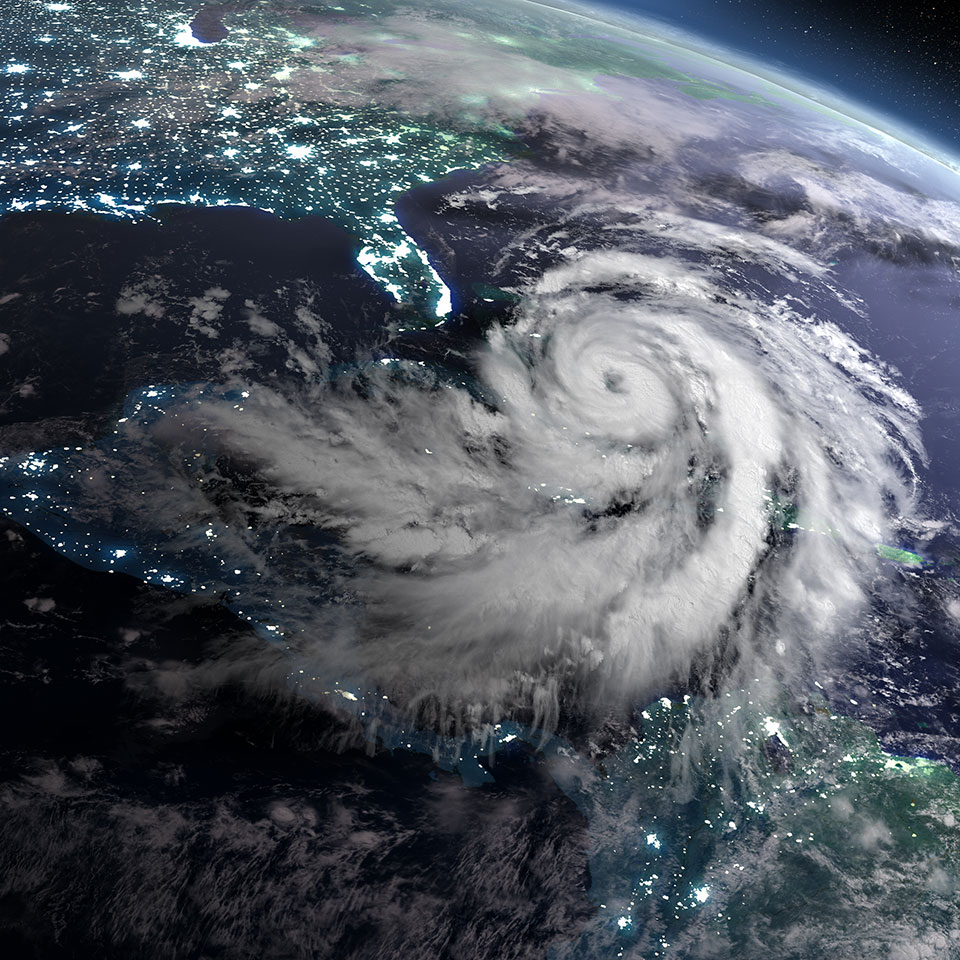
Characteristics of Hurricanes
At the core of a hurricane’s structure, there is a complex arrangement of elements:
- Eye - The eye of the hurricane is a central, calm region with clear skies as this is where the air sinks.
- Eyewall - This is the surrounding ring of violent thunderstorms where the strongest winds and heaviest rainfall are present.
- Spiral bands - These are bands of clouds and thunderstorms that spiral outward from the eyewall.
The two critical indicators of a hurricane’s strength are its central pressure and wind speed.
The central pressure is the atmospheric pressure at the hurricane’s centre. The lower the pressure, the more powerful the storm. The wind that circulates the eye is a key factor in determining the category the hurricane will be placed in.
As briefly mentioned earlier, hurricanes are categorised based on their wind speeds using the Saffir-Simpson Hurricane Wind Scale, ranging from Category 1 (weakest) to Category 5 (strongest). Each of the five categories is associated with wind speeds and potential damage. It is the most important tool for communicating the severity of an approaching storm.
Consequences
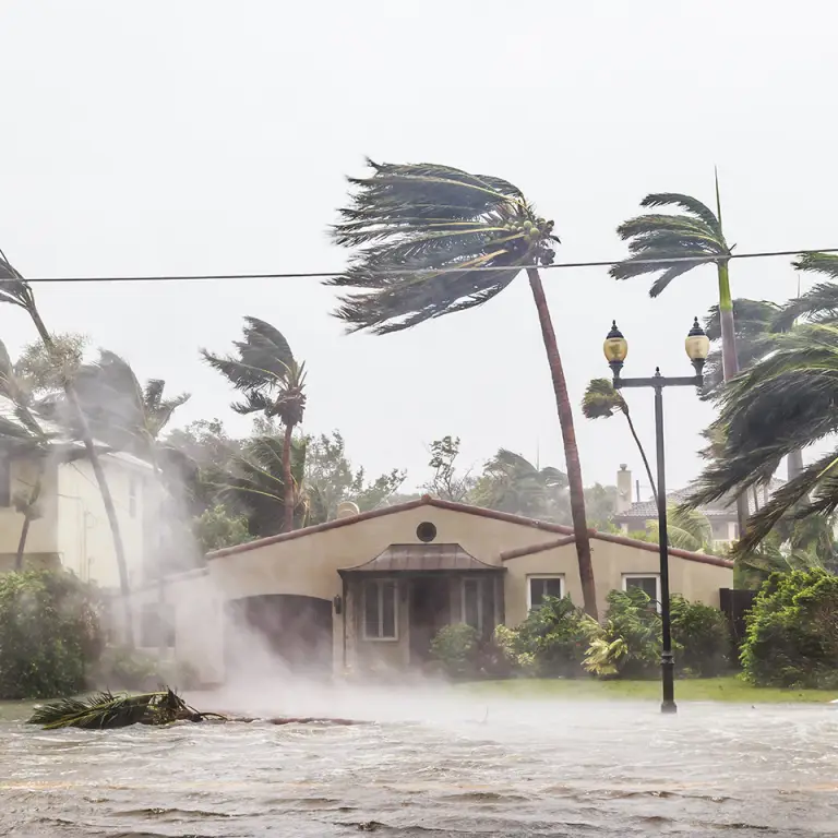
Hurricanes are powerful and destructive storms that can cause devastating consequences in coastal areas and inland regions.
- The primary drivers of destruction during hurricanes are the powerful winds and the accompanying storm. The sustained high-speed winds can reach extreme velocities that have the capacity to destroy structures and uproot trees. A storm surge is a surge in sea levels caused by the combination of wind and low atmospheric pressures; this worsens the devastation caused by the hurricane and can severely flood coastal areas.
- Coastal areas are usually the most vulnerable, experiencing the full force of the wind and storm surge. Homes, businesses, and critical infrastructure situated near the shoreline are particularly vulnerable. Due to the impact, coastal erosion then becomes accelerated, leading to valuable land being lost.
- As mentioned, hurricanes are categorised based on their sustained wind speeds, with the higher categories indicating more destructive potential. The destructive force of a Category 4 or 5 hurricane can result in the near-total destruction of buildings, causing extensive power outages and long-lasting disruptions to essential services. The aftermath requires significant effort to rebuild.
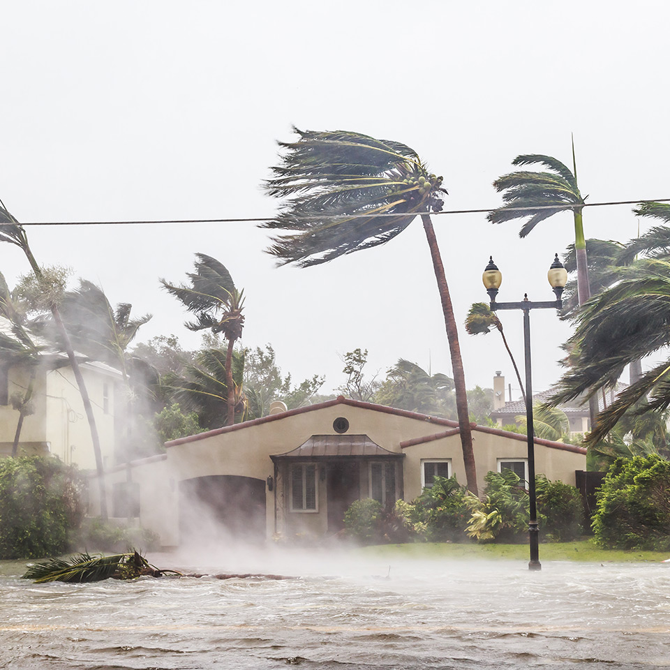
- In addition to the winds, hurricanes also bring torrential rainfall that often leads to widespread flooding in regions far beyond the immediate path of the storm. The consequences of intense rainfall can include river overflow, flash floods, and the submersion of low-lying areas.
- As hurricanes move inland, the risk of flooding continues. Urban areas that have poor drainage systems are particularly vulnerable when it comes to flash floods as they can occur so quickly.
- The force of hurricanes can inflict severe damage on infrastructure such as roads and bridges. Coastal structures then face the additional risk of corrosion from saltwater exposure.
- With heavy rainfall, the soil becomes more saturated meaning landslides are more likely to take place, especially in hilly areas.
If you’d like to study further and learn more about the origins, structure, and historical context of hurricanes, consider enrolling in our Introduction to Hurricanes diploma course for just £29 (save £118!). You’ll also explore concepts of physics, oceanic interactions, atmospheric circulation, and other concepts about the generation of large cyclonic storms!